
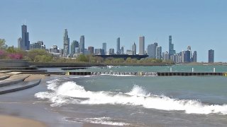
While air temperatures will continue to stabilize after a midweek heat wave, gusty winds and high waves on Lake Michigan will also arrive in force on Saturday.
Accordingly, the National Weather Service has issued a beach hazards statement, which will remain in effect through Sunday morning.
Waves of 4-to-7 feet are expected throughout the day Saturday and into Sunday, with occasional waves of up to nine feet.
Residents are urged to stay out of the water, and to avoid breakwalls and beachfront paths at this time.
The waves will be driven by increasing wind gusts, which could reach 20-to-30 miles per hour throughout the day Saturday.
Those winds come as humidity levels are expected to drop in the Chicago area, with decreasing dew points making for much-more pleasant conditions after this week’s heat wave.
High temperatures are expected to settle into the upper-70s throughout the area, with cooler readings near Lake Michigan.
Local

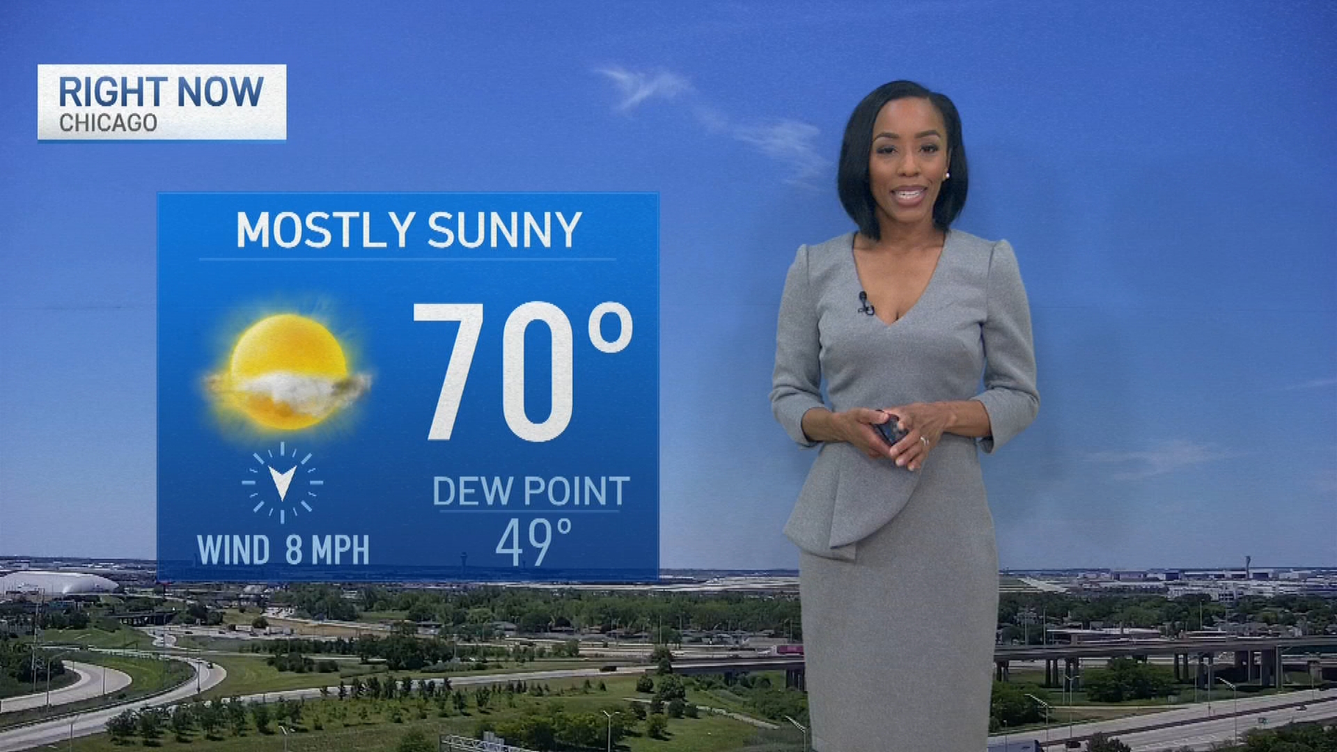
By Sunday, dew points are expected to drop into the 50s, with high temperatures only reaching into the mid-70s.
Temperatures will warm slightly Monday and into Tuesday, reaching up to near 80 degrees, but a weak cold front could bring some showers and thunderstorms to the region Tuesday, and will then drop temperatures to around 70 degrees by Wednesday.
Feeling out of the loop? We'll catch you up on the Chicago news you need to know. Sign up for the weekly Chicago Catch-Up newsletter here.
Stay tuned to the NBC 5 Storm Team for all the latest weather information.
