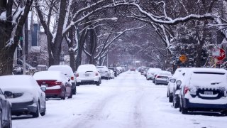
With leaves starting to fall and Halloween fast approaching, it’s natural to think about upcoming snowy days in the city of Chicago.
According to official estimates, the city typically sees around 37 inches of snow per year, but the last few years have seen totals fall well below that. In the 2023-24 winter season, Chicago recorded 22.2 inches of snow, marking the third straight year of below-average accumulations.
So what do the months ahead hold? Let’s take a look at the data.
When does Chicago see its first trace of snow?
On average, Chicago will have seen its first trace of snow by Oct. 31, according to data published by the National Weather Service.
The earliest the city has ever seen snow in a given season was on Sept. 25, with traces of snow recorded on that date in both 1928 and 1942, according to NWS officials.
The latest first trace of snowfall the city has recorded occurred in 1999, when there wasn’t a single snowflake until Dec. 5.
Local
In 2023, Chicago’s first trace of snowfall arrived exactly on time, as the area received 0.9 inches of snow on Oct. 31, according to NWS records. The city then went nearly a month without any more snow, but did finally report some on Nov. 26.
Here are some other earliest snowfall dates from the last decade in the city of Chicago:
Feeling out of the loop? We'll catch you up on the Chicago news you need to know. Sign up for the weekly Chicago Catch-Up newsletter.
2014-15: Oct. 4
2015-16: Nov. 20 (4.2 inches of snow fell on this date, with seven inches the following day)
2016-17: Nov. 19
2017-18: Oct. 28
2018-19: Oct. 20
2019-20: Oct. 30 (1.2 inches of snow fell, with 3.4 inches falling the next day)
2020-21: Oct. 26
2021-22: Nov. 12
2022-23: Oct. 17
What about measurable snowfall?
In terms of measurable snowfall, defined as 0.1 inches or more of accumulation, NWS says the average first date for Chicago get that wintry experience is on Nov. 18.
The earliest measurable snowfall Chicago has recorded occurred on Oct. 12, 2006, while the latest occurred on Dec. 28, 2021.
Here’s a rundown of the earliest first measurable snowfalls of the last decade:
2014-15: Oct. 31 (0.1 inches)
2015-16: Nov. 20 (4.2 inches)
2016-17: Dec. 4 (6.4 inches)
2017-18: Nov. 10 (0.1 inches)
2018-19: Nov. 9 (1 inch)
2019-20: Oct. 30 (1.2 inches)
2020-21: Nov. 24 (1.4 inches)
2021-22: Dec. 28 (1.5 inches)
2022-23: Nov. 15 (1 inch)
2023-24: Oct. 31 (0.9 inches)


