
After rapidly intensifying into a Category 5 storm, Hurricane Milton is slowly churning toward the Florida peninsula, with life-threatening storm surges and ferocious winds expected in coming days.
Rains associated with the storm are expected to begin arriving days before it officially makes landfall, with tropical storm-force winds and the bulk of the moisture arriving on Tuesday night and into Wednesday, according to the National Hurricane Center.
The storm, which intensified from a Category 3 hurricane into a Category 5 storm within a matter of hours Monday, is also impacting Mexico’s Yucatan Peninsula before it makes its way across the Gulf of Mexico toward Florida.
Here’s the latest on how the storm is expected to proceed toward the Sunshine State.
Monday Night
Milton is still located just north of the Yucatan Peninsula in Mexico, where it is expected to cause significant issues, including a “life-threatening storm surge” and damaging waves along the coast, according to officials.
Local
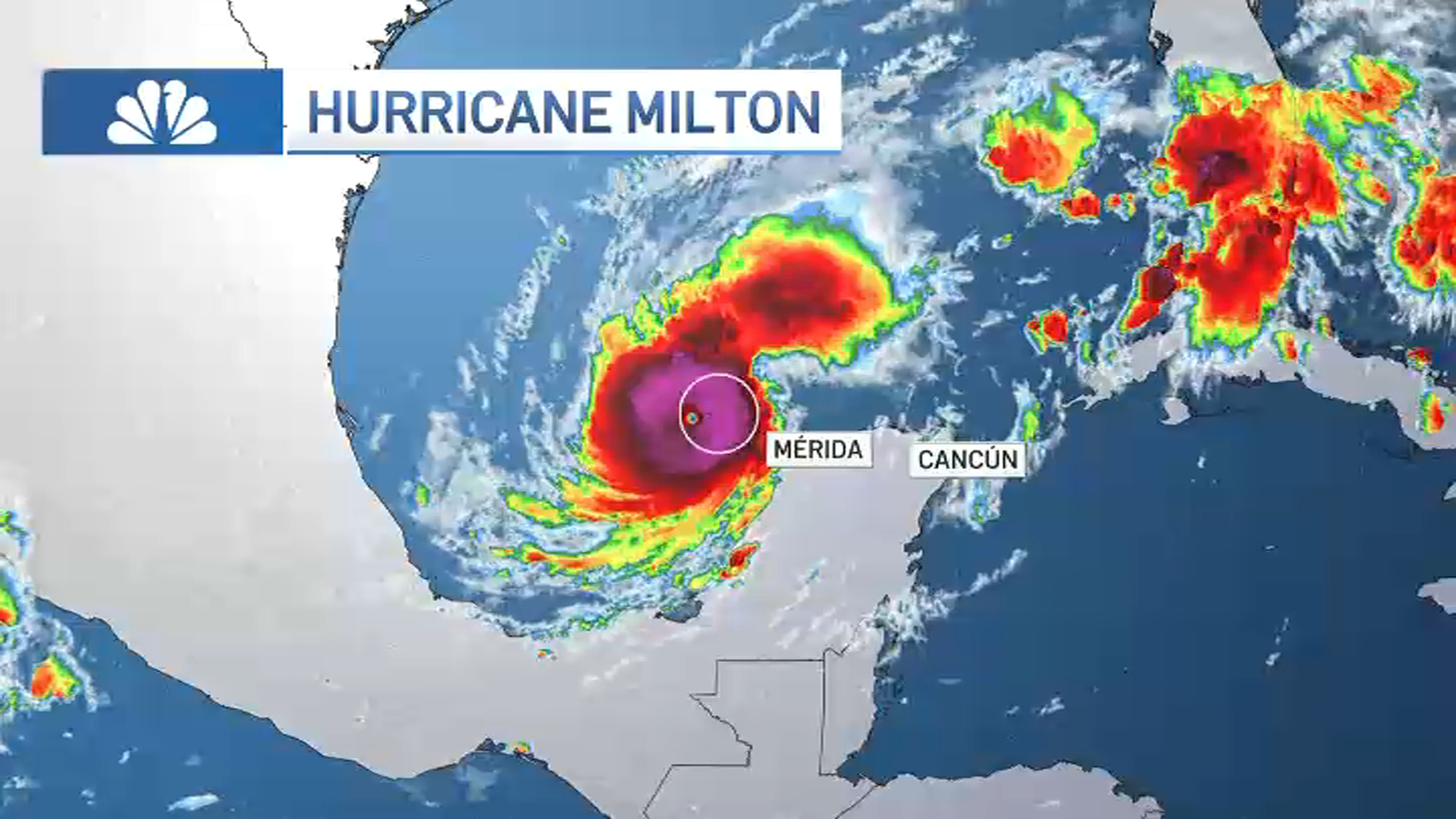

Heavy rains and damaging winds are also expected as the storm drifts toward the east-northeast.
Tuesday Morning
Feeling out of the loop? We'll catch you up on the Chicago news you need to know. Sign up for the weekly Chicago Catch-Up newsletter.
The storm is still expected to be located along the Mexico coast Tuesday morning, with hurricane warnings still in effect as heavy rains continue.
What’s more, rain bands out in front of the hurricane are expected to begin stretching out toward the Florida coast, meaning that some showers and thunderstorms could begin impacting the state 36 hours or more before the storm officially makes landfall.
According to officials, Tampa International Airport will also halt operations beginning at 9 a.m. Tuesday due to the approaching storm.
Tuesday Night
By the evening hours Tuesday, the storm will be moving away from Mexico and toward the Florida coast, impacting western portions of Cuba as it churns across the Gulf as a powerful hurricane.
More rain will also start pushing into Florida out ahead of the hurricane, with flood watches and warnings likely as the day wears on.
Wednesday Morning
By the late morning hours, tropical storm-force winds are expected to arrive across most of the state, with heavy rain also impacting a wide swath of the state from the panhandle all the way down to the Florida Keys.
Operations at Orlando International Airport are expected to be suspended Wednesday morning ahead of the hurricane’s arrival.
The storm is expected to weaken as it approaches the state, but will still be considered a major hurricane by the time it makes landfall, according to current estimates.
Wednesday Evening
The storm is expected to make landfall on Wednesday night, and could do so near heavily populated areas of the state near Tampa and St. Petersburg, according to estimates.
There is a potential for a massive storm surge associated with the hurricane, between 8-to-12 feet as it enters Tampa Bay and similarly high in other nearby coastal areas, with an area between Yankeetown and Bonita Beach all potentially seeing massive rises in water levels.
Due to the heavy rainfall, there is considerable risk of flash flooding, as well as moderate-to-major river flooding in effected areas.
It is a virtual certainty that areas of central Florida will see tropical storm-force winds or greater as the storm passes through, according to modeling from the National Weather Service.
Even if the hurricane weakens into a Category 3 storm, sustained winds between 110-to-130 miles per hour would still be possible in areas near the eye of the hurricane.
Thursday
By Thursday morning, the bulk of the storm is expected to have passed over the Florida peninsula, but it’s likely still going to be socking the area with rain, and could cause flooding issues along the Atlantic coast.
The heaviest rains are currently expected across the middle portions of the state, and could impact several large cities, including Tampa and Jacksonville.
In total, between 6-to-8 inches of rain or more could fall in most areas, though localized totals up to 15 inches are possible.
There is a “moderate” risk of flash flooding across most of the peninsula.